

Online dashboard maps spread of Covid-19 across Ireland
Donegal County Council has created an online dashboard that provides maps and data for Covid-19 cases nationwide.
Built using Esri Ireland’s digital mapping platform, the freely available dashboard compiles data from the Department of Health and Public Health Northern Ireland. The hub is updated daily and provides information on confirmed cases such as age profile, transmission cause and number of infected healthcare workers.
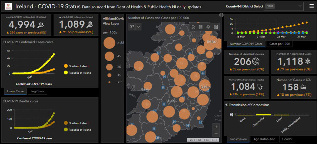
Percentage and actual increases in figures, including the number of healthcare workers infected and number of cases in ICU, can be tracked via the dashboard. Links to official guidelines and information from the HSE, Department of Health, Public Health Northern Ireland and World Health Organisation are also available on the platform.
Esri Ireland also compiled Covid-19 Impact Planning infographics for every county in Ireland, detailing the preparedness of each country for coronavirus. It provides population breakdowns, work status of population and total numbers of healthcare facilities in the county.
TechCentral Reporters


Subscribers 0
Fans 0
Followers 0
Followers