

Esri powers NI map of publicly accessible greenspace
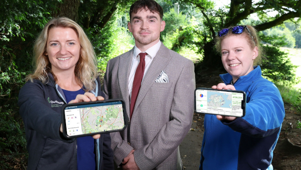
A first-of-its-kind interactive map of greenspaces and trails in Northern Ireland has been released. Created by Outscape, a not-for-profit organisation making it easier for people to enjoy the outdoors, the GreenspaceNI Map currently records 85,818 hectares of publicly accessible greenspace and approximately 2,700km of off-road trails in the region.
The map was built using Esri’s ArcGIS technology and supported by geographic information consultancy Geolytical, aims to empower communities and promote healthier lifestyles by encouraging the public to utilise nearby greenspaces and trails. The map will help citizens to become more active by making them aware of their local parks and trails for both recreation or walking and cycling to school or work. It also highlights beaches, woodlands, and nature reserves that are open to the public.
In addition, the map will be used to inform planning policies and focus attention on the need for more greenspaces, as it provides clear evidence of inequitable access to these greenspaces in Northern Ireland.

An analysis conducted with ArcGIS Pro found that 56.6% of people living in urban areas were within 400 metres of a greenspace, while 8.7% of people in rural areas, including small towns and villages, have this same level of access.
The Northern Ireland Executive’s draft Programme for Government Wellbeing Framework and DAERA’s recently published Environment Strategy both commit to achieving an annual increase in the number of people who live within 400 metres of a greenspace or off-road trail, and the ongoing development of the GreenspaceNI Map will enable progress to be monitored over time.
The map not only provides insights into where the greenspaces are, but also where they are not, and where there is a lack of provision. The tool will aid local planning and community engagement, helping authorities and community groups to advocate for better access to greenspaces.
The key metrics from this geospatial analysis were also published to ArcGIS Online using operations dashboards and interactive ArcGIS StoryMaps.
Emma Taylor, GIS technician at Outscape, said: “ArcGIS provided us with a platform with which we could carry out complex geospatial analysis and rapidly share the results in a variety of engaging ways, without the need for coding or development work. To share the insight in an accessible way, ArcGIS Dashboards and StoryMaps bridge the gap between those with advanced GIS skills and those with no prior knowledge, making information easily accessible to everyone.”
Elizabeth Annett, communication & praining principal, Outscape, said: “Improving access to greenspaces is becoming an important policy priority. There was no way of quantifying publicly accessible greenspace before, but now we can monitor whether greenspace development is heading in the right direction. ArcGIS has given us the evidence required to demonstrate precisely where investment in more greenspaces is most needed.”
This new map was made possible by grant aid investment from the Dept of Agriculture, Environment & Rural Affairs (DAERA), SportNI, and the Dept for Infrastructure on behalf of the cross-departmental Strategic Outdoor Recreation Group.
TechCentral Reporters


Subscribers 0
Fans 0
Followers 0
Followers